The Pacific Is Taking California's Front Row, and the Worst Is Still Ahead
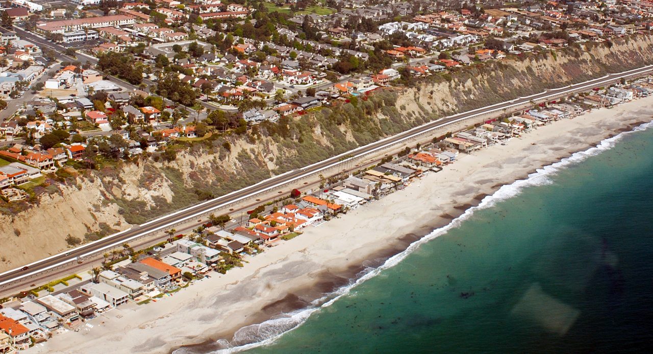
Photo: Don Ramey Logan / CC BY-SA 3.0 · via Wikimedia Commons
The Pacific Is Taking California's Front Row, and the Worst Is Still Ahead
A Boardwalk That Ends in Midair
The Long Beach Peninsula is a narrow sandspit with the Pacific on one side and Alamitos Bay on the other, and for a century its wooden boardwalk was the thing that stood between the ocean and the houses. Between Oct. 9 and 11, the remnants of Tropical Storm Rachel took roughly 30 feet of it, boards and pilings together, and left the debris drifting offshore. Along Seaside Walk the fronts of homes were torn open, seawater pushed into living rooms and mud and sand filled the lanes behind. Long Beach Fire Department Assistant Chief Jake Heflin said the tide that night could reach 7.8 to 8 feet, unusual for a bay sheltered by a breakwater.
Eight Buildings, Thirteen Homes, Red Tags
Inspectors red-tagged eight buildings containing 13 residences on the 6400 and 6500 blocks of Seaside Walk, meaning no one may enter, and yellow-tagged one more, allowing brief supervised retrieval of belongings. The city ordered a mandatory evacuation from 7 p.m. Friday through noon Tuesday for homes between 64th and 66th Places and closed the Peninsula to nonresident traffic. Mayor Rex Richardson said it was the third hurricane in six weeks. "It is not normal that we see this type of activity," he said.
Sacramento Moves Three Months Early
On Sept. 21, Gov. Gavin Newsom proclaimed a statewide emergency, months before the winter storms it is meant to answer. The order puts the National Guard, the transportation department and utilities on heightened readiness, directs agencies to pre-position equipment, supplies and flood-fighting material across all 58 counties, and requires an inventory of vulnerable bridges, culverts and transmission lines. Natural Resources Secretary Wade Crowfoot said the point was to cut red tape and finish protection work "before the worst storms arrive." The state framed the move as pre-positioning, not disaster response.
A Super El Niño on Top of a Kelvin Wave
The surf is not only weather. On Oct. 8 the NOAA Climate Prediction Center put the odds above 83 percent that this El Niño stays strong to very strong through January to March 2027; other forecasts give it a 75 percent chance of becoming the strongest on record since 1950. A Kelvin wave is pushing north along the West Coast and adding 6 to 12 inches to sea-surface height off California. Patrick Barnard of UC Santa Cruz said the coast should expect "historically unprecedented elevated sea levels, as well as very large waves, acute beach loss, and extensive flooding."
Five Feet a Year
The Atlantic reported that a stretch of beach in Dana Point, inside a federal flood zone, is retreating about five feet a year, and that California sea level has risen roughly one foot in 125 years. The U.S. Geological Survey modeled in 2017 that up to two-thirds of the state's beaches could disappear by 2100 if seas rise three to six feet, with 31 to 67 percent of Southern California beaches eroding completely. The beach is the first line of defense; when it goes, only the foundation is left.
Fifty Thousand Dollars a Household
Dana Point got there first. On Beach Road, waves dragged one house into the ocean and forced the city to vacate or restrict 16 others; at the September peak, 10 carried red tags. Homeowners pooled their own money, trucked in boulders and built a barrier in front of the row, at more than $50,000 per household. The California Coastal Commission issued emergency permits covering 17 properties on condition that the rock come out after 120 days unless permanent approval follows.
The Seawall Trap
This is California's oldest coastal argument, and it has not been resolved. Coastal Commission spokesperson Joshua Smith said seawalls can give homes "temporary relief" while increasing erosion and destroying the public beach that protects those same structures. In 2022 Newsom vetoed SB 1078, a pilot program that would have helped local governments buy out vulnerable coastal properties. Researchers argue the arithmetic points one way: nourishment projects run into tens of millions of dollars, and at some point buying the houses will be cheaper than adding sand forever.
A Crack Ten Feet From the Highway
On Oct. 13 a fissure opened in the bluff beneath Pacific Coast Highway near Crystal Cove, about 10 feet from the roadway. Caltrans closed one southbound lane between Reef Point Drive and Irvine Cove Drive with no reopening date. Brett Sanders of UC Irvine warned that continued failure could sever the link between Laguna Beach and Newport Beach.
What Gets Washed Away Besides Houses
In Carlsbad, north of San Diego, Tamarack beach lost its sand almost overnight; beach tourism generates 14 percent of the city's operating budget. Rail service through San Clemente was suspended again along a line that carries about $1 billion in freight a year. Santa Monica canceled a beachfront music festival after storm surge eroded the site.
Sand on Oct. 19, Winter Behind It
Long Beach accelerated an $11.4 million dredging and nourishment project that will pull 415,000 cubic yards of sand from the Alamitos Bay Channel and push the beach about 200 feet seaward, starting Oct. 19. Boardwalk and bulkhead repairs are estimated at $1.5 million to $3.6 million, paid from the Tidelands Emergency Reserve, on top of $1 million to $1.5 million a year just to move sand from the wide end of the beach to the narrow one. El Niño is expected to peak between October and December, with effects running into early 2027. The harder question is not how to build the next wall, but which stretches of coast are worth keeping, and who signs for them.
Sources
- Los Angeles Times: Heavy surf, red-tagged homes, a battered boardwalk: Long Beach confronts costly climate reality
- LAist: Long Beach orders evacuations, fast-tracks plans to rebuild beach as waves pound the Peninsula
- The Atlantic: The Edge of California Is Falling Into the Ocean
- Reuters: Rising sea destroys homes, erases beaches in California. Is worse to come?
- The Washington Post: Fight intensifies over the fate of homes falling into the sea