Super Typhoon Champi, 2026's Strongest Storm, Takes Aim at Taiwan After Darkening Guam
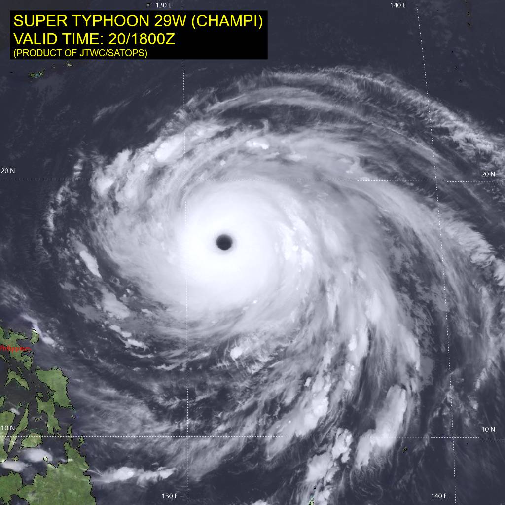
Photo: Joint Typhoon Warning Center / Public domain · via Wikimedia Commons
Super Typhoon Champi, 2026's Strongest Storm, Takes Aim at Taiwan After Darkening Guam
Peak Winds of 296 km/h Crown a New Wind King
Super Typhoon Champi has become the strongest tropical cyclone of 2026 by wind speed, with peak sustained winds reaching 296 km/h. It surpassed Hurricane Polo, which had held this year's record at 285 km/h. By the competing measure of central pressure, Polo remains more intense: its minimum of 892 millibars is lower than Champi's 895 millibars. On October 21 the storm was packing winds of up to 245 km/h as it moved toward waters east of Taiwan, threatening widespread disruption across Taiwan and China's southeastern coastline.
A 10-Mile Miss Still Halves Guam's Power
On the morning of October 18, Champi skirted just 10 to 12 miles south of Guam's southern tip as the equivalent of a Category 4 hurricane with 150 mph winds. Just six hours later it intensified into a Category 5 with 165 mph sustained winds, according to the Joint Typhoon Warning Center. The Guam Power Authority reported electricity reaching only about half the island on Sunday morning. Of the island's production wells, 87 were online, down from 101 before the storm, with 78 running on generator power. The Red Cross supported 15 shelters across Guam, Saipan, Tinian and Rota, where more than 1,000 residents took refuge, while as many as 170 wells were reported out of operation. Guam Memorial Hospital delivered 16 babies after the island moved to its highest readiness condition.
Taiwan's Weather Agency Flags Friday and Saturday
Taiwan's Central Weather Administration says Champi will be closest to the island on Friday and Saturday, bringing strong winds and heavy rain to the north and east, especially Yilan and Hualien counties along with central and northern Taiwan. A sea warning could come as early as Wednesday night, with a land warning following on Thursday. On October 18 the storm was about 2,470 kilometers east-southeast of Eluanbi, Taiwan's southernmost tip, tracking west-northwest at about 20 km/h; by October 20 it had closed to roughly 1,500-plus kilometers with maximum sustained winds near its center of 198 km/h. Forecasters warn of waves up to six metres off the east coast.
Zhejiang Evacuates the Vulnerable, Halts Ferries and Offshore Works
China's National Meteorological Centre expects Champi to make landfall along Taiwan's eastern coast around Saturday as a strong typhoon, possibly followed by a second landfall in Fujian, and maintains a blue typhoon warning, the lowest in its four-tier system. Authorities in Zhejiang province have begun evacuating vulnerable residents, including the elderly, pregnant women and people with disabilities, while suspending 36 passenger ferry routes and halting work on 223 marine construction projects. Aviation data platform VariFlight flags potential disruption at airports serving Wenzhou, Fuzhou, Ningbo, Hangzhou, Shanghai's Hongqiao and Pudong, and Xiamen, though no large-scale delays or cancellations have been announced.
Landfall or a Sharp Turn: The Track Still Wobbles
Forecasts diverge after Taiwan: one scenario carries Champi across the island and into Fujian, while an updated outlook has it turning northeast near Taiwan, brushing the northeastern coast before heading toward waters southwest of Japan. AccuWeather expects rainfall of up to 18 inches (450 mm) across Taiwan, with a local maximum of 36 inches (900 mm) in the east, bringing floods, mudslides and transport paralysis. Taipei Mayor Chiang Wan-an said a decision on office and school closures would follow existing procedures, likely announced Thursday. Champi is the third typhoon to batter Guam and the Northern Mariana Islands in six months; Super Typhoon Sinlaku killed six people in the Northern Mariana Islands when it struck Saipan in April.
Sources
- Focus Taiwan