Typhoon Champi Bears Down on Taiwan: Land Warning Issued, 125 Flights Cancelled, Japan Grounds 100+
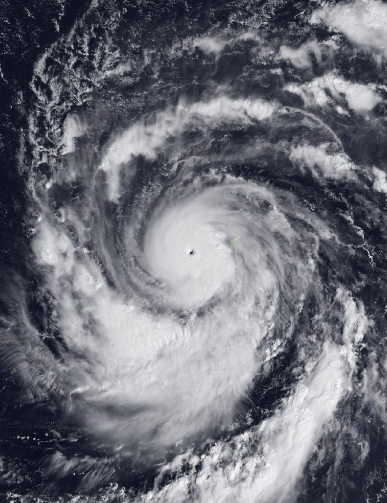
Photo: AHI imagery from JMA's Himawari-9 satellite / Public domain · via Wikimedia Commons
Typhoon Champi Bears Down on Taiwan: Land Warning Issued, 125 Flights Cancelled, Japan Grounds 100+
Taiwan Issues Land Warning as Champi Packs 141 mph Gusts
Taiwan's Central Weather Administration (CWA) issued a land warning Thursday as Typhoon Champi approached the island. The CWA said gusts near the storm's center remained above 227 km/h (141 mph) despite slight weakening on Thursday. The storm was about 520 km (320 miles) southeast of Taiwan's southern tip, and its radius had widened to about 320 km (199 miles) — enough to cover most of Taiwan.
Closest Approach Late Friday, Then North Toward China
Forecasters expect Champi to pass closest to Taiwan late Friday, skirting the island's northeastern coast before turning north toward the seas off Shanghai and eventually moving into southern Japan. Taiwan authorities warned of destructive winds, torrential rain and waves exceeding six meters.
Taiwan Cancels 125 Flights; Two Carriers Drop Okinawa Routes
Taiwan cancelled 125 flights as the storm approached. China Airlines and Tigerair Taiwan cancelled Thursday's flights to Okinawa, and two domestic carriers dropped some services to outlying islands. It is the second round of disruption from the same storm, which grounded flights at Guam over the weekend.
Japan Grounds 100+ Flights, Disrupting 11,000 Passengers
Japan Airlines, ANA and Skymark cancelled more than 100 flights, mostly domestic, between Thursday and Sunday, disrupting travel for over 11,000 passengers. The typhoon is forecast to pass over Japan's westernmost inhabited island, Yonaguni, in Okinawa Prefecture. JAL said many flights at nine island airports including Naha would be cancelled October 22-24, and ANA cancelled all Miyako and Ishigaki flights for October 23.
Keen Sword Drills Disrupted by Approaching Storm
The approaching storm is also disrupting the major military exercise called Keen Sword underway around Japanese islands near Taiwan, forcing changes to the US-Japan drill schedule.
China's Coast Faces Heavy Rain and Gale-Force Winds
China's Central Meteorological Observatory forecast sustained strong winds and heavy rain along the southeast coast. From the night of October 23 through October 26, eastern and northern Fujian, eastern and northern Zhejiang, and Shanghai expect heavy to torrential rain, with local downpours; cumulative rainfall of 90-150 mm in parts of eastern Zhejiang, eastern Fujian and southern Shanghai, with coastal areas locally exceeding 200 mm. Gale-force winds of 6-8 with gusts to 9-10 are expected across most of the East China Sea, Taiwan Strait, waters east of Taiwan and the Bashi Channel, rising to 10-12 near Taiwan.
Once a Super Typhoon, Champi Still Packs 120 mph Gusts
Champi was at one point a super typhoon and one of the strongest storms in the Pacific this year. Strong winds from Champi, with gusts up to 120 mph, are expected to affect Taiwan and eastern China from Thursday night into Sunday, potentially causing structural damage, prolonged power outages and transportation delays. The Joint Typhoon Warning Center's latest update put Champi's maximum sustained winds at nearly 195 km/h.
Not Chanthu: A Separate Storm on a Different Track
Champi is a separate storm from the recent Typhoon Chanthu, with a different track and impact area. Champi is expected to pass off northeastern Taiwan, turn north toward the Chinese coast and move into southern Japan.
Taiwan on Alert as Path Clarifies by October 26
China's meteorological agency said Champi's later path and impacts are expected to become clearer on October 22. Taiwan has placed emergency services on standby. The storm is projected to turn northeast around October 24 and gradually weaken, but Taiwan and eastern China still face heavy rain, strong winds and high seas before then.
Sources
- Japan Today: Taiwan issues land warning ahead of arrival of powerful Typhoon Champi
- KFGO: Taiwan issues land warning ahead of arrival of powerful Typhoon Champi
- The Times of India: Typhoon Champi: Taiwan issues land warning, cancels 125 flights as powerful storm approaches
- Yahoo: Super Typhoon Champi becomes one of 2026's strongest storms as it heads toward Taiwan and eastern China
- AOL: Super Typhoon Champi becomes one of 2026's strongest storms as it heads toward Taiwan and eastern China