California's Storm Door Swings Open as an Atmospheric Firehose Takes Aim
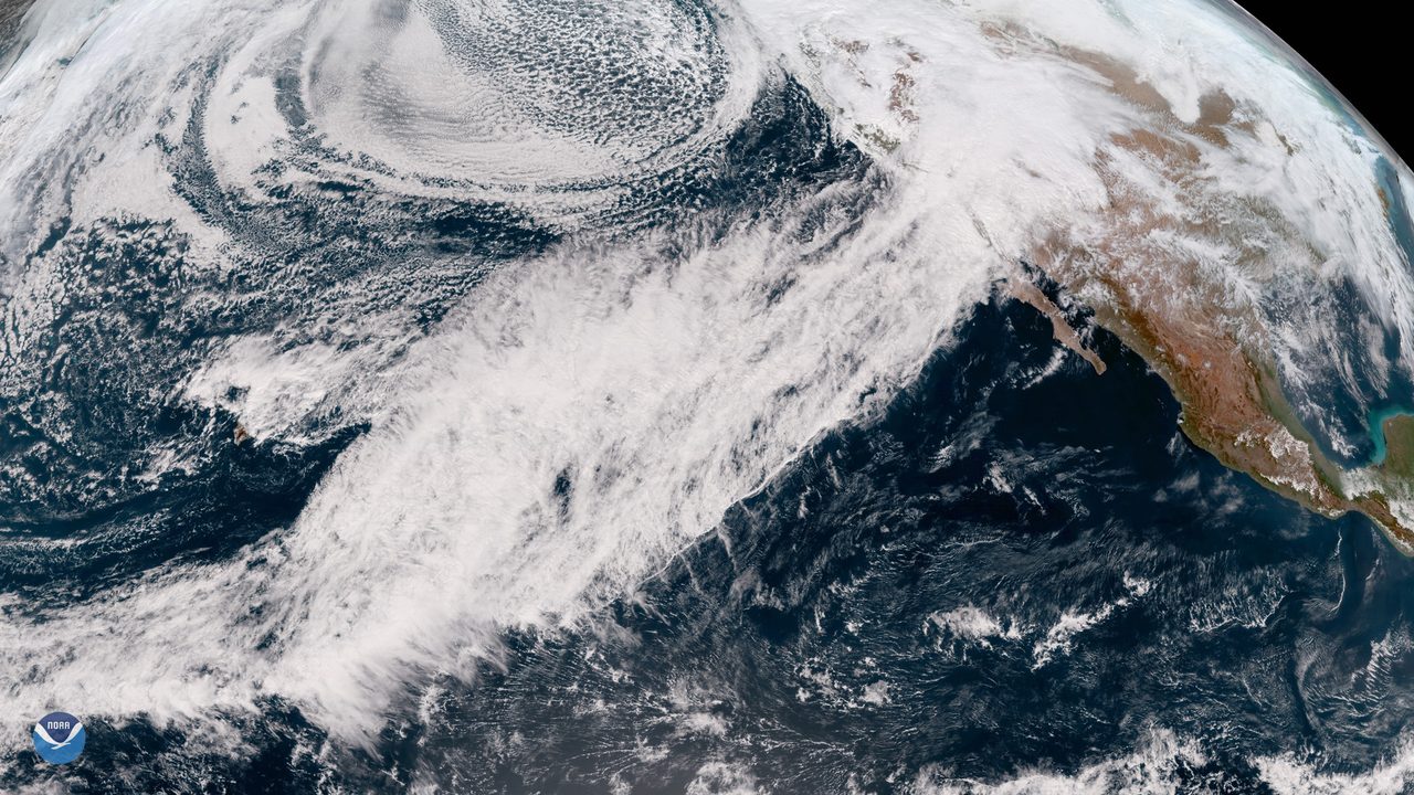
Photo: NOAASatellites / Public domain · via Wikimedia Commons
California's Storm Door Swings Open as an Atmospheric Firehose Takes Aim
A Pattern Flip Puts California in the Crosshairs
California's storm door is about to swing wide open. The San Francisco Chronicle reported on October 23 that an atmospheric firehose could soon take aim at the state, with a major pattern change likely taking shape in the last week of October and possibly persisting into the first full weekend of November. That puts a wet and stormy Halloween and Election Day on the table. Forecasters describe it as the seasonal switchover: the Pacific moisture pipeline locking onto the West Coast for weeks at a time.
The First Fall Storm Already Flooded Streets
The season's opening storm has already shown its teeth. On October 22, heavy rain, gusty winds and thunderstorms swept Central California, flooding neighborhoods and prompting first responders to urge caution. The same system slammed Southern California with hail, damaging winds and flooding. In Victorville, fierce winds sent trash and debris swirling across roadways; one driver called it the most intense, frightening wind she had ever experienced in person. Trees crushed cars in Hollywood, rescuers pulled a man from the Pacoima Wash in North Hills, and a dusting of snow fell on Mount Baldy.
Sacramento Valley Gets Its First Measurable Rain
Northern California recorded its first significant showers of the season. KCRA's rain map showed about a quarter-inch in Sacramento, more than a third of an inch in Stockton and more than a quarter-inch in Modesto as of 8 a.m. on October 23, with nearly four-fifths of an inch in Tracy and around Arnold and Sonora. Light rain lingered in the Foothills and Sierra before the region dried out by midday, a modest prelude to the much wetter systems lining up offshore.
Newsom Pre-Positions an Army of Sandbags
Governor Gavin Newsom's office announced on October 21 that California has declared a state of emergency and is preparing for what could be a record-strong El Nino winter. The state has staged emergency supplies at 70 locations statewide, including more than 6 million sandbags, 52,000 feet of portable flood barriers and 400,000 tons of rock for emergency levee repairs, while crews inspect roughly 1,600 miles of levees. Newsom одновременно accused the Trump administration of retreating from federal disaster duties, saying Washington is telling states to handle catastrophes on their own.
Burn Scars Face Danger From Half an Hour of Rain
The gravest official warning concerns fresh wildfire burn scars. The National Weather Service put thunderstorm chances at 30 to 40 percent for Los Angeles and Ventura counties, with a widespread risk of minor flooding and debris flows. Research from the U.S. Geological Survey shows it takes as little as 0.3 inch of rain in 30 minutes to trigger a debris flow on a fresh scar, with any intensity above about 0.4 inch per hour considered dangerous. Flood watches were issued for the Malibu coast and Santa Monica Mountains, where rain rates near 0.75 inch per hour are possible.
Commuters and Coastal Towns in the Flood Path
Commuters and coastal communities stand most exposed. The California Highway Patrol warned that even a few inches of rain can turn flooding deadly enough to sweep a vehicle away, urging drivers to slow down, turn on headlights and never drive through flooded roadways. Forecasters expect around 1.5 inches across much of Los Angeles County, with 2 to 3 inches where terrain enhances rainfall or thunderstorms hit, plus a 5 percent or smaller chance of a weak tornado. The high Sierra could see a half-foot of snow or more, with a slight chance of waterspouts along the coast from Monterey to Orange County.
Bigger Atmospheric Rivers Queue Up for November
More is coming behind this storm. USA Today reported that AccuWeather forecasters expect the first major atmospheric river as early as mid-November, striking most frequently in January and February, driven by the strongest El Nino on record. Warmer-than-normal ocean water will add fuel, raising the odds of coastal thunderstorms, flash flooding and damaging gusts all winter. For Californians, the message from every agency is the same: clear the drains, know your flood risk, and get ready for a long, wet fight.
Sources
- San Francisco Chronicle: California's storm door is about to swing wide open
- ABC7: From hail to fierce winds, wild weather slams communities across SoCal
- KFSN: Storm drenches Central California, flooding streets and prompting safety reminders
- KCRA: Map: Rain totals across Northern California
- Governor of California: Governor Newsom slams Trump's disaster retreat as California prepares for dangerous El Niño storms