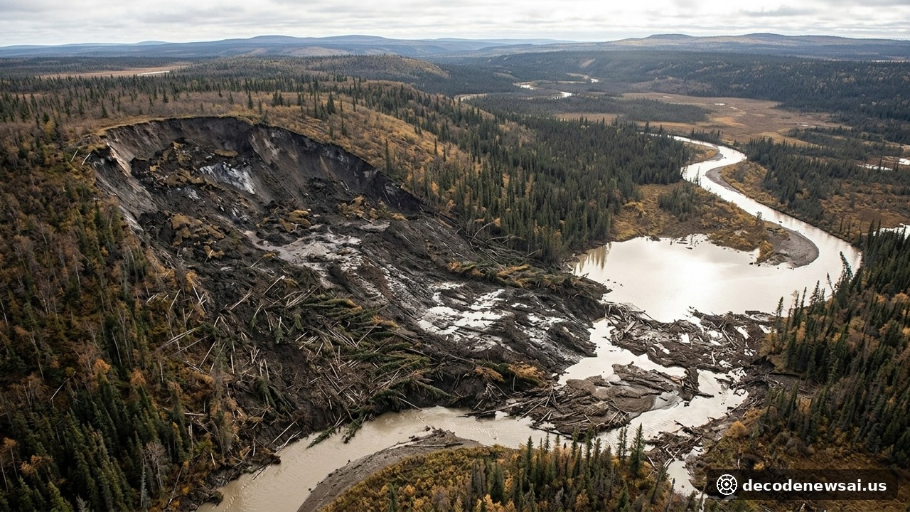
A geological research consortium led by Dr. Joseph Young from the University of Alberta published groundbreaking field findings in Geophysical Research Letters, documenting a previously unrecognized mechanism of Arctic slope failure. The investigations reveal that massive permafrost slabs in the Mackenzie Valley detached from their deep basal boundaries, moving approximately 4.5 million and 18 million cubic meters of frozen ground across two distinct valley slopes. The deep-seated failures occurred at depths between 18 and 20 meters beneath the surface.
Deep basal sliding overturns conventional thaw slump theories
Deep Basal Sliding Overturns Conventional Thaw Slump Theories
Permafrost degradation in subarctic environments has historically manifested as retrogressive thaw slumps, where exposed ice-rich headwalls retreat gradually through seasonal surface melting. Investigations conducted across the Redstone River and Johnson River basins documented a structurally distinct failure mode.
Field surveys revealed that entire intact forest canopies and intact blocks of frozen substrate slid downhill in singular coherent movements. Detailed aerial photogrammetry and satellite elevation models demonstrated that sliding took place along deep detachment planes situated 18 to 20 meters underground, well below the seasonal active layer.
Geologists formally designated this high-magnitude process as a permafrost detachment slide. The phenomenon represents the first documented occurrence of full-thickness permafrost failure decoupling along deep basal contacts in northwestern Canada.
Enormous debris masses dam river channels to create natural lakes
Enormous Debris Masses Dam River Channels to Create Natural Lakes
Geomorphological calculations revealed that the Redstone River slide mobilized roughly 4.5 million cubic meters of glacial till along a 1.2-kilometer scar traversing a 16-degree hillside. The Johnson River collapse exhibited even larger dimensions, releasing approximately 18 million cubic meters of lacustrine mud across a two-mile expanse.
The displaced icy debris filled drainage channels below, completely obstructing river flow. Impounded meltwater behind the debris barriers generated two substantial lakes measuring 1.1 kilometers and 3.5 kilometers in length.
Electrical resistivity tomography lines demonstrated high electrical resistance corresponding to 20 meters of permafrost outside the slide margins, contrasted with complete resistivity loss within the failure scar. Isotopic analysis confirmed that basal ice along the detachment surface formed during the early Holocene epoch, establishing that the failures disrupted permafrost that had remained stable for millennia.
Wildfire thermal degradation and hydraulic fissures drive deep thawing
Wildfire Thermal Degradation and Hydraulic Fissures Drive Deep Thawing
Geophysical thermal models developed by the research team traced the structural trigger to severe boreal forest fires that burned across the Mackenzie Valley in 1995. The destruction of surface moss and peat insulating layers allowed summer atmospheric heat to penetrate progressively deeper over two decades.
Thermal degradation opened extensive tension cracks along upper ridgelines, allowing warm seasonal rain and surface meltwater to channel directly to the bottom of the permafrost stratum. This hydraulic circulation accelerated bottom-up thawing along the interface between frozen till and underlying unfrozen substrate.
Elevated pore-water pressure and basal softening eliminated shear strength along the deep boundary plane. The overlying permafrost slab subsequently detached under gravitational stress, sliding rapidly across gentle slopes.
Accelerating Arctic warming poses emerging infrastructure threats
Accelerating Arctic Warming Poses Emerging Infrastructure Threats
Throughout the central Mackenzie corridor, permafrost thickness ranges between 20 and 40 meters, with mean annual ground temperatures hovering precariously near minus 1 degree Celsius. Regional climate stations recorded warming trends averaging 0.3 degrees Celsius per decade from 1980 to 2020.
The authors warn that expanding wildfire regimes and climatic warming will heighten detachment slide hazards across northern Alaska and subarctic Canada. Emerging permafrost hazards require updated engineering standards for linear infrastructure including all-weather highways, telecommunications corridors, and pipeline crossings.
The multi-year investigation received financial backing from PermafrostNET and the Northwest Territories Geological Survey. The research team plans to initiate expanded aerial radar surveys across the Mackenzie watershed in early 2027.