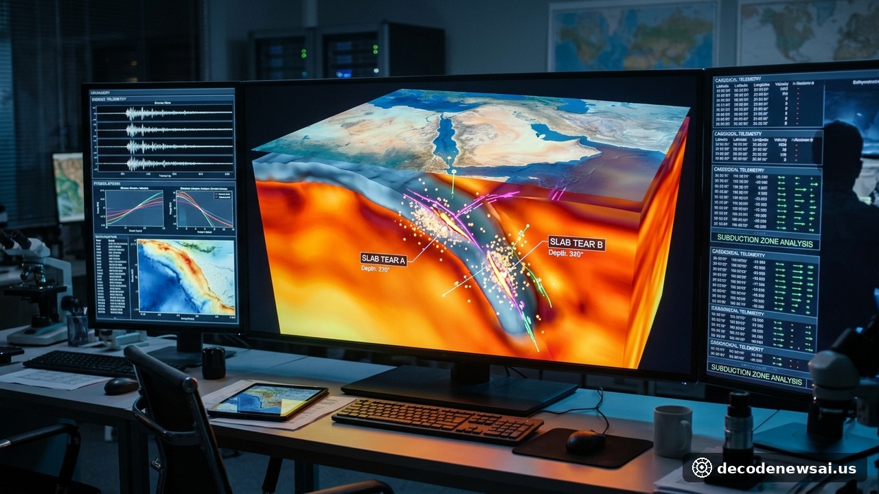
An international team of geophysicists led by researchers from the Institute of Geology and Geophysics at the Chinese Academy of Sciences published breakthrough geophysical findings on November 10, 2026, confirming the discovery of two colossal tears within the subducting Arabian Plate beneath southeastern Iran. Utilizing high-density broadband seismic array tomography and full-waveform inversion, the research team mapped the deep three-dimensional structural geometry of the subducted lithosphere, providing definitive empirical evidence that resolves decades-old scientific debates regarding mantle dynamics and catastrophic seismic activity across the Middle East.
Slab tears reveal asthenospheric upwelling and alter models
The collision between the Arabian and Eurasian continental plates constitutes one of the most tectonically active convergent boundaries on Earth.
While plate convergence has historically driven mountain-building across the Zagros and Makran belts, the deep subsurface fate of the descending slab remained poorly constrained due to limited seismic instrumentation. Detailing the discoveries at a scientific symposium, senior research leadership stated: "High-resolution seismic tomography provides unambiguous visual evidence of two parallel, lithospheric-scale slab tears within the subducting plate. This fundamentally alters classical geological models that assumed continuous, homogeneous plate subduction across the plate boundary."
The tomographic models reveal that buoyant, hot asthenospheric mantle material is vigorously upwelling through the lithospheric tears, significantly altering regional geothermal gradients and crustal stress fields.
Tears correlate with magnitude 7.0 earthquakes and hazards
The spatial coordinates of the identified tectonic tears correlate directly with localized swarms of historically devastating earthquakes measuring magnitude 7.0 or greater. Stress concentrations generated along the edges of the severed plate transfer elevated strain toward active upper-crustal fault systems.
Seismologists and geotechnical hazard agencies noted that mapping sub-crustal slab fragmentation enhances long-term earthquake hazard forecasting across the northern Indian Ocean and adjacent continental margins. Furthermore, the localized influx of warm asthenosphere provides a long-sought geochemical explanation for anomalous intraplate volcanic fields dotting the Iranian plateau. The research consortium confirmed plans to expand integrated ocean-bottom seismic telemetry across the Gulf of Oman to monitor ongoing slab detachment velocities.
Solid Earth geophysicists and plate tectonics researchers noted that high-resolution seismic tomography provides invaluable empirical constraints for understanding complex continental collision zones. Because subducting tectonic slabs experience intense thermal and mechanical stresses as they descend into the upper mantle, identifying localized structural tears illuminates the dynamic forces driving regional earthquake distribution and mantle fluid circulation. Geotechnical hazard mitigation authorities emphasized that integrating deep subsurface mapping into national seismic hazard models significantly improves regional disaster preparedness. International scientific consortia affirmed that collaborative geophysical monitoring remains indispensable for advancing fundamental Earth science knowledge.
Deep-Earth geodynamicists link slab tears to hazard models
Deep-Earth geodynamicists and seismic hazard researchers observed that mapping structural lithospheric tearing provides essential clues regarding the long-term evolution of continental convergent boundaries. Because regional mantle flow fields respond directly to slab geometry, identifying deep structural tears enhances numerical simulations of tectonic deformation and earthquake triggering mechanisms. Geological survey agencies emphasized that continuous high-resolution geophysical monitoring is critical for refining localized building codes and strengthening disaster mitigation infrastructure across earthquake-prone metropolitan regions.
In addition, international geophysical associations emphasized that collaborative seismic monitoring enriches humanity's understanding of planetary geodynamics. Researchers worldwide commended the scientific breakthrough for opening new pathways in earthquake forecasting and geodynamic modeling.
Furthermore, computational seismologists affirmed that integrating advanced tomography algorithms significantly enhances structural Earth models. The international scientific community looks forward to analyzing expanded deep-crustal datasets in upcoming field campaigns.
International collaboration vital for geodynamic hazard forecasts
Geological researchers affirmed that international scientific collaboration remains vital for developing reliable geodynamic hazard forecasts. The scientific research consortium plans to publish expanded spectroscopic and seismic datasets to support ongoing global plate tectonic investigations.
Scientific collaborators noted that high-resolution Earth models provide critical support for regional hazard mitigation efforts. The international research team looks forward to presenting expanded geophysical findings at upcoming international conferences.